All about hiking, biking, and climbing in the Black Hills of South Dakota.
Sunday, July 17, 2011
Tuesday, July 12, 2011
Stratobowl Rim Trail
The Stratobowl Rim Trail is a very easy trail just east of Rockerville on Highway 16. Beginning at the highway, this trail winds through dense pine forest and eventually ends at an overlook with plaques and monoliths. The majority of the trail is used as a maintenance road so it is wide and fairly well maintained.
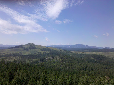
The trailhead is located about two miles west of Bear Country on Highway 16 south of Rapid City. After Bear Country there is a gas station. Take an immediate right after the gas station to turn into the trailhead parking lot. Here you will find a tiny parking area and a gate across the road. While hiking through the forest the views are of trees but you will be rewarded at the end of the mile long hike when you are on top of the east rim of the bowl. Other than the views, there is a plaque and a memorial giving the history of the area and great information about what flew out of the Stratobowl back in the 1930's and 1950's. At the overlook there are also a few choices for other short trails.
One thing I found odd is that the big stone monoliths with the history of the Stratobowl are encased in a chain link fence. I assume the fence is to prevent vandalism, but it looses it's aesthetic appeal and turns into an eyesore…
| Gate at trailhead |
One thing I found odd is that the big stone monoliths with the history of the Stratobowl are encased in a chain link fence. I assume the fence is to prevent vandalism, but it looses it's aesthetic appeal and turns into an eyesore…
Monday, July 4, 2011
Upper Spring Creek
Upper Spring Creek is a trail head off of Sheridan Lake Road below the dam at Sheridan Lake. It is a section of the 111 mile long Centennial Trail and also leads to the Flume Trail. Although very short, this is a favorite place of mine to go for a hike or trail run, especially on a hot summer day.

Starting almost at Sheridan Lake Road, this section of the Centennial Trail meanders slightly uphill following Spring Creek until the dam at Sheridan Lake just over a mile away. Once at the dam there are many options of where to go next. You can keep going on the Centennial Trail towards Dakota Point or take a short trail to the Flume Trail or just turn around and head back. On those hot, sunny days, it's always fun to do a little swimming and cliff jumping into the lake to cool off.
While on the trail, the scenery is amazing with the creek wandering through the valley and between the rock walls. The trail varies between a narrow single track and a wide, rocky path. Along the way there are three creek crossings which have recently been given bridges, but you can still walk through the water if you choose! Another great thing about this area is the fishing in the creek. The trout are abundant and waiting… In the summer months, beware of poison ivy and mosquitoes.
The Upper Spring Creek Trail Head is about two miles east of Highway 385 or nine miles west of Red Rocks Golf Course/Corner Pantry. Look for the trailhead sign on Sheridan Lake Road and follow the road about half a mile to the trail head parking lot.
Labels:
Fishing,
Hiking,
Trail Running
Location:
Upper Spring Creek TH
Subscribe to:
Posts (Atom)

